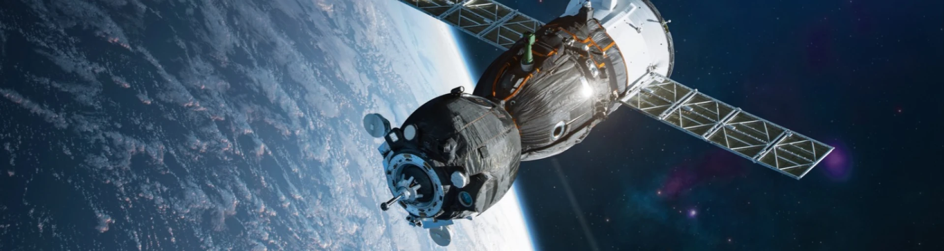

As part of the Dynamic Solar project, SpectX and TU/e are developing a swarm of small drones to monitor the performance of large solar parks.
Objective: to map the solar irradiance on PV panels and distinguish between yield variations and faults.
Focus on simulations: advanced navigation and decision-making algorithms are first thoroughly validated before field tests take place.
The technology is widely applicable: opportunities for Dutch industry in inspections within the energy sector, agriculture and environmental monitoring.
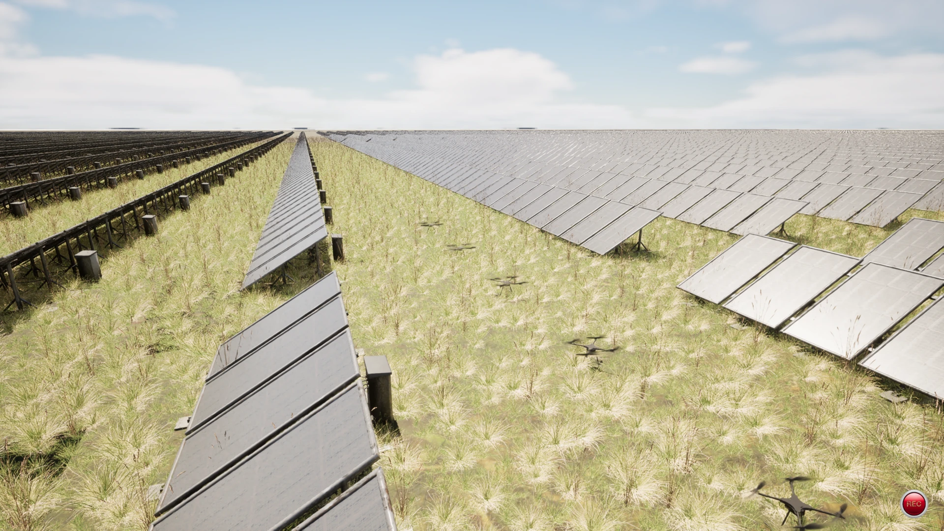
Dynamic Solar: SpectX and TU/e are developing smart drone navigation to monitor the performance of solar parks
9 July 2026
Solar farms are becoming increasingly large and, as a result, more difficult to manage using traditional sensors. In the Dynamic Solar project, inspection specialist SpectX is working with Eindhoven University of Technology (TU/e) on a method to monitor the performance of solar panels efficiently and cost-effectively using a swarm of small drones.
The Dynamic Solar project receives support from Holland High Tech under the PPP Innovation Scheme (PPS-I) run by the Ministry of Economic Affairs and Climate Policy. This article is the third in a series of articles on the impact of innovation through PPS-I projects.
* Source photot: SpectX
To ensure that photovoltaic (PV) solar panels in large solar farms operate at their best, more is required than simply monitoring their output in kilowatt-hours. Individual panels may fail, become damaged or become soiled by, for example, dust, sand or bird droppings. When the output is lower than expected, it is therefore necessary to determine whether there is a fault or simply less sunlight. To do this, irradiance measurements are compared with the actual electricity production.
In an installation with a relatively small number of panels – for example, on a roof or in a small solar park – designers install a static sensor to measure the incident light at a specific point.
When planning new solar parks, designers are looking at ever-larger installations. For example, the Vlagtwedde I and II solar parks in Groningen already cover an area of around 120 hectares. Abroad, there are already parks covering an area of 160 hectares.
Light distribution across such a large park can vary considerably; for example, a cloud might cast a shadow over one part of the park, whilst another part is bathed in sunlight. Installing just a few static sensors therefore provides an incomplete picture. “For panels situated 200 metres away from a static sensor, you can no longer be sure whether the measurement is accurate. That information simply isn’t available,” explains Milosz Plucinski, Simulation Engineer at SpectX, a drone inspection company based in Delft. Installing these static sensors in many more locations is too costly. The specialists at SpectX therefore realised that the use of drones could provide a mobile complement to the static measurements.
The social impact of Dynamic Solar
SpectX has extensive experience in inspecting industrial structures that are difficult to access, such as offshore wind turbines, high-voltage cables, bridges and process plants. Solar farms are also included in this, although in this case the focus is more on inspecting the structure. In the Dynamic Solar project, SpectX aims to explore further how drones can help map the solar irradiance on the PV panels and analyse the performance of the solar farm.
Mani Kamalzadeh, CEO of SpectX, emphasises the social importance of this research project. “In doing so, we are contributing to greater sustainability. Energy has always been one of the cornerstones of human development. The transition to renewable energy is essential to keep this process going. According to the International Energy Agency (IEA), solar energy from PV panels is expected to be the fastest-growing source of renewable energy in the future. This means that the reliability and output of solar energy depend to a large extent on solar irradiance. In fact, Dynamic Solar enables us to manage and plan this aspect more effectively.”
“The reliability and output of solar energy depend to a large extent on solar irradiance.”
Mani Kamalzadeh, CEO of SpectX
The idea of using a swarm of microdrones to carry out measurements for a yield analysis arose during a brainstorming session with a number of scientists from the Department of Mechanical Engineering at TU/e. In her previous role at the University of Seville, Assistant Professor Paula Chanfreut Palacio of the Control Systems Technology research group had already gained experience in measuring incident light at large solar parks using mobile robots and drones.
Using a swarm of autonomous drones, it should be possible to create a highly accurate map of the light distribution across such a large area. That map can then be compared with the panels’ output during the same period. To create the map, it is not necessary to fly systematically over the entire surface. Thanks to the drones’ smart navigation, it is possible to identify, in particular, the transitions between sunny and shaded areas. “We have a fairly good idea of what lies between the boundaries of those areas,” explains Plucinski.
Drones must coordinate their navigation with one another
This project requires new, advanced navigation and decision-making algorithms. Much of the development work is being carried out at TU/e. Field trials are not yet on the agenda, explains researcher Koen de Vos from the Mechanical Engineering group at TU/e. SpectX and the researchers involved in this Dynamic Solar project first want to optimise the drones’ navigation using simulations. Plucinski: “The concept we are working on is challenging and first requires very thorough validation through simulations.” To this end, he developed a highly realistic simulation environment of a solar park. De Vos is using this environment to test and refine the new drone algorithms. The simulation environment now includes highly realistic cloud imagery. “If this ultimately works well in the simulation, we are very confident that it will also work in practice,” assures Plucinski.
A complex interplay of decision-making algorithms
“In theory, there are an infinite number of points to measure, but there are only a limited number of drones,” says De Vos, outlining the challenge of the project. “The clouds are constantly moving, so after each measurement point, the drone has to decide in real time which measurement point to fly to next. What’s more, the drones have to coordinate with one another to determine which part of the task each will take on.” This enables the algorithm to prevent overlap and make optimal use of measurement capacity.
“The clouds are constantly moving, so after each measurement point, the drone has to decide in real time which measurement point to fly to next.”
Koen de Vos, researcher in the Mechanical Engineering group at TU/e
Elena Torta, a lecturer in robotics at TU/e, adds that weather conditions are also a key factor in the research. There is almost always air movement above a solar park. It is possible to minimise the effect of gusts of wind by only taking measurements under ideal flying conditions. However, in such conditions there are often fewer clouds, which cause the variations in light that the project participants are interested in. “Making effective use of the drones therefore means we need to develop advanced stability controllers that keep the drone in position. At the same time, we need to develop systems that prevent the drone from colliding with anything if it is blown out of position by a gust of wind.” A drone crash onto a solar panel naturally causes significant damage straight away. Furthermore, the drones have limited battery capacity, which the algorithm must take into account whilst navigating.
The results are widely applicable
Torta emphasises that the algorithms developed through this research are not limited to measurements on solar panels. “Autonomous robots are increasingly being used for inspections in various areas of the energy sector. The technology we are developing here could prove useful in this regard.” Plucinski also highlights the potential of algorithms capable of tracking dynamic boundaries. In agriculture and forestry, for example, this could be used to map the spread of plant diseases. “There are probably many phenomena that behave in this way, with a pattern of spread and a clear boundary.”
“Autonomous robots are increasingly being used for inspections in various areas of the energy sector.”
Elena Torta, Assistant Professor of Robotics at TU/e
“There are probably many phenomena that behave in this way, with a distribution and a clear boundary.”
Milosz Plucinski, engineer at SpectX
This also creates new opportunities for Dutch industry. Kamalzadeh emphasises that drone research is currently a major focus of attention. This project is developing various technological building blocks that other companies can reuse. Apart from swarm navigation, research is being carried out at Dynamic Solar into sensor integration, data collection and processing. The results of this research can be applied, for example, to environmental monitoring.
Previous articles in the series: